About Me
I am a 1st Year Undergraduate Geology student at the
University of Plymouth in the United Kingdom. My home county is Hampshire, but
I have moved to the beautiful West Country in order to work towards my goal of
being a seismologist for a geohazards agency. I wish to ultimately move to New Zealand and work for GeoNet in some sort of research and analysis capacity.
Inspiration from The Land of the Long White Cloud (Aotearoa)
My personal story begins in February 2010 when I went for a
family holiday to the wonderful country of New Zealand. Staying in Christchurch
for the first week (as part of a motorcycle international rally), I was able to
take in the city, its friendly people and its breathtakingly stunning
surroundings. In that first week visits to Arthur’s Pass and Otira Viaduct in
the Southern Alps, as well as Lyttelton Harbour and Akaroa on the Banks
Peninsula made me appreciate just picturesque nature’s landscapes can be.
 |
| Lyttelton Harbour, the site of the Port Hills Earthquake of 22nd February 2011; Taken 12th February 2010 |
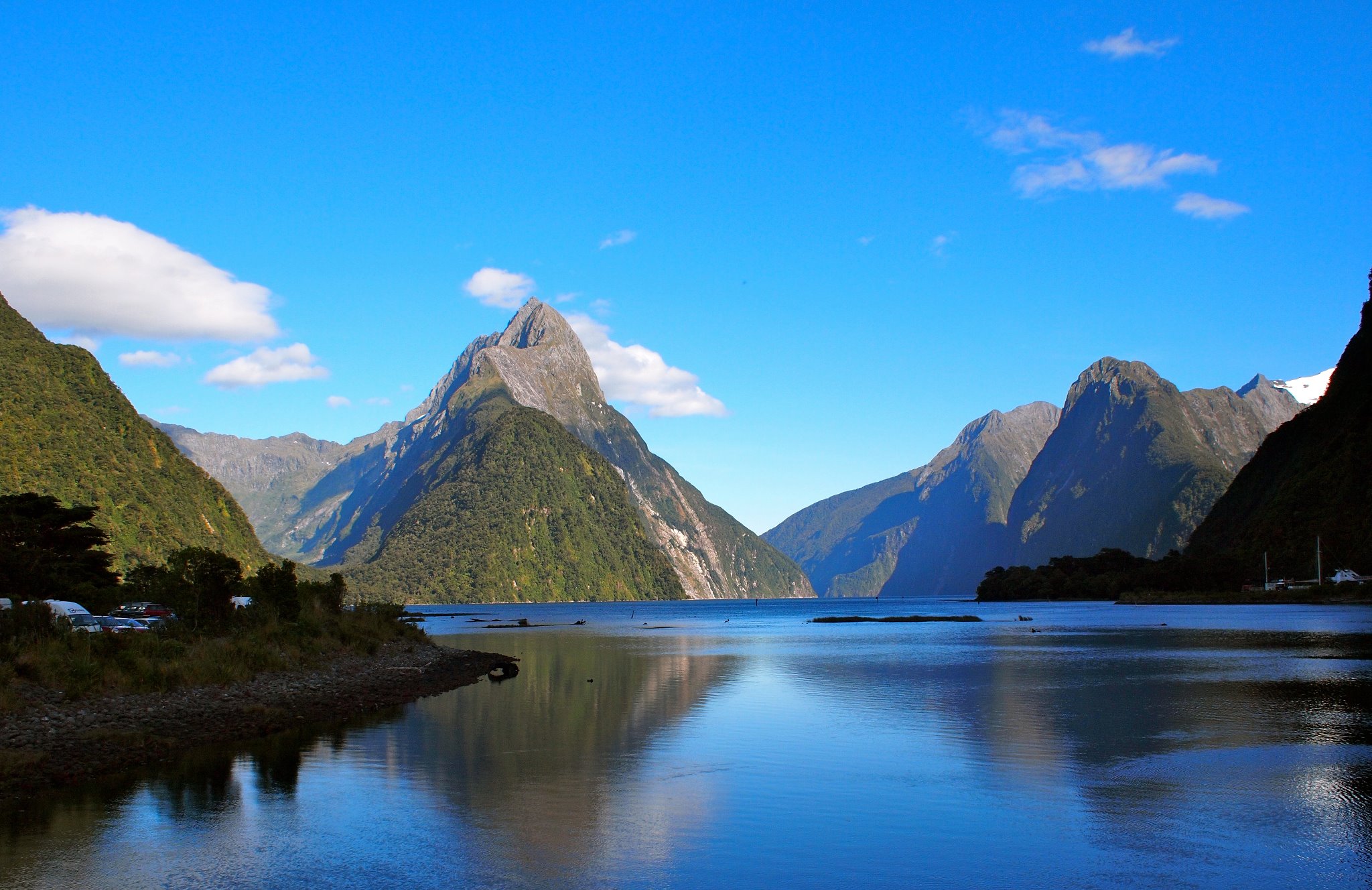
In my second week in New Zealand I journeyed about the South
Island; I saw the Moeraki Boulders on the east coast, viewed the graceful Royal
Albatross from the Otago Peninsula, visited the Petrified Forest at Curio Bay
on the south coast, had a coach ride and cruise along the Milford Track and
Milford Sound respectively, and then had a helicopter ride up to the Tasman
Glacier and over The Divide at Mount Cook. Each sight made me feel more
appreciative of the world, and it is fair to say that the trip had a profound
impact on me. A family friend lived in Christchurch, and we stayed with her for
our final night before flying back to rainy Britain.
 |
| Looking down at Queenstown, with Deer Park Heights in middle distance and The Remarkables in the background; Taken 17th February 2010. |
In September 2010 a moment magnitude 7.1 earthquake struck 9
kilometres south-east of Darfield, Canterbury Province. During my first full
day over there we had stopped at a rather rough pizza place for dinner in
Darfield, so hearing that the small town had been badly damaged and seeing
pictures of the manor used in the film The
Chronicles of Narnia: The Lion, The Witch and The Wardrobe completely
destroyed was rather shocking. I think even by that time I had decided that I
would love to move out to New Zealand, and to see the country I had been in
severely shaken was a shock.
Just over a year after I left Christchurch, a moment
magnitude 6.2 earthquake struck just south of Christchurch, in the Port Hills
separating Lyttelton from the city itself. The 22nd February 2011
earthquake was devastating. The symbol of the city, the 150-year old AnglicanCathedral, was badly damaged, the spire collapsing completely. Other buildings
were badly damaged as well, including the Historic Timeball in Lyttelton (which
was being renovated when I was over there), the Pyne Gould Building and the
Canterbury Television (CTV) Building. The latter two were built in the 1970s
and were not designed to withstand earthquakes of moderate sizes. Both
collapsed, with 18 killed in the Pyne Gould Building and 115 killed in the CTV
Building. Overall 185 people lost their lives, the centre of the city was
turned into an exclusion zone and the lives of the Cantabrians were changed
forever.
Footage of the damage to the city was heart-breaking. The
earthquake made the news for a short while, but it’s impact internationally was
soon overshadowed by the massive moment magnitude 9.0 quake that struck two
weeks later in Japan. Footage of the immediate aftermath of the Christchurch
quake is still accessible, especially on YouTube, and even now, 3 and a half
years later, I feel a lump in my throat watching such clips.
It took a while to hear from our family friend in Ilam, a western suburb of the city. One letter
she sent said of how, whilst looking after a relative’s dog, an aftershock
struck the city. The dog was spooked and ran out into the road, only to be hit
by a passing car. It was poignant reminder of the effect the earthquake had had
on the local community, humans and animals alike. The Red Zone, as the
exclusion zone in the centre of city came to be known, was finally removed in
June 2013; despite this, the city is still rebuilding, with a temporary
cardboard cathedral one of the amazing innovations that has made the news in
recent months.
Deeply affected by the quake and its effects, I began to
look into what had caused it. This led me to start recording earthquakes in New
Zealand and Europe after the New Brighton Earthquake struck east of
Christchurch on the 13th June. Since then, with few exceptions, I
have been recording earthquakes somewhere around the world in one form or
another.
As a side-effect of my hobby I have learnt much about plate
tectonics, the cause of seismic activity, the nature of earthquakes and how to
interpret individual events and the threats they pose. One of the first
agencies that I used was GeoNet, a subsidiary organisation of the Geological
and Nuclear Sciences in New Zealand. Their website has changed two times since
I began using their website, and the advances in recording, particularly after
big earthquakes, such as Christchurch and Seddon, have allowed me to gain a
deep understanding of New Zealand seismicity.
The July – August 2013 Seddon Sequence in central New
Zealand became a key moment in my understanding of seismology. At the time I
needed a large amount of seismic data to analyse for a college qualification
called the Extended Project, and Seddon proved ideal (even if it did bring an
end to two years of New Zealand M4+ quake records). The Seddon Sequence is
incredibly simple, but due to the sheer number of earthquakes involved was
overwhelming. Even now small aftershocks, mostly M2-3 in size, are striking the
region. My mini-dissertation on the Seddon Sequence and its evolution over time
allowed me to widen my knowledge of seismology, finding out about different
types of faults, how they are shown on moment tensor solutions, the different
types of magnitude scales, the effects of location and depth in regard to how a
quake is felt by people, and the relationship between a mainshock and its
aftershocks.
Inspiration from Closer to Home
In October 2013 I visited the barren-seeming island of Iceland.
Before I left for the country, a large earthquake swarm struck the westernmost
tip of the Reykjanes Peninsula in south-west Iceland. I had not taken much
notice of seismicity in Iceland, so it was an eye-opener into a new part of the
world. The Icelandic Meteorological Office soon became a mainstay of my record
sources and remains so to this day, especially after the start of the current
Barðarbunga eruption in the Vatnajökull Ice Sheet.
 |
Looking northwards at Skógafoss, south of Mýrdalsjökull, southern Iceland;
Taken 19th October 2013.
|
The most recent development in my understanding of
seismology, and the principal reason why this website has been set up, follows
a holiday to Guernsey in the Channel Islands in April 2014. On the penultimate
day of my holiday I visited the main office for La Société Guernesiase (The
Guernsey Society) in St Peter Port. I asked for a list of any articles relating
to geology for the island, mainly to answer a question about the metamorphic
rocks of West Vazon. By coincidence some of the early articles related to
historical earthquakes in the area. I took a punt having flicked through some
of the pages and bought three of these volumes (i.e. Report & Transactions,
1929).
 |
| Looking eastwards towards Herm and Sark, from Fort Doyle in north-east Guernsey; Taken 9th April 2014. |
Two of the volumes, dating from 1929 and 1938, had included
an article with A Catalogue of
Earthquakes felt in the Channel Islands. The article is one of the most interesting
and eye-opening pieces of scientific writing for someone unused to considering active
seismicity in north-west Europe. Amongst its contents there are records of big
earthquakes in 842, 1091, 1161, 1750, 1773, 1799, 1853, 1863, 1889 and 1927
being felt or striking the Channel Islands. Several of these occurred in
Normandy or Brittany, others in the English Channel and some in the Channel
Islands themselves. The February 1927 earthquake was a magnitude 5.4 event and
was felt as far away as London and Lisieux in eastern Normandy, causing minor
plaster damage to houses in Jersey; it occurred in the same location as a quake
in June 1926.
This was proof to me that such events could happen at any
time in the near future. I left my contact details with the lady at La Société
Guernesiase and after initial correspondences did not expect any further
contacts for a long while. I was proved wrong when in July a magnitude 4.2 earthquake struck south-west of Jersey and she emailed me saying she had felt
the quake on Guernsey at lunchtime. This was the largest quake to strike the
Channel Islands since a magnitude 5.2 in 1933 and had a large number of
aftershocks, including two which were felt on Jersey.
Mission Statement
This website has therefore been set up to bring awareness to
people within the UK and neighbouring countries of the threat of seismic events
occurring today. It is also aimed at bringing awareness of seismicity worldwide
in the present day, and as should be expected there will be a focus on New Zealand
due to my own experience. The threats faced are very real and are certainly surprising
to all, and I hope to make such threats better known by all.
This article was written by J H Gurney on the 17th October 2014.
No comments:
Post a Comment